Editor: 邵丹蕾 Author: Time: 2019-08-26 Number of visits :454

The School of Earth Sciences of Zhejiang University(SES) organized a summer school at University of Illinois at Urbana-Champaign(UIUC) from July 26th to August 12th, 2019 for undergraduate students. 30 students participated in the summer school, and 23 of them were from our school. Associate Professor Du Zhenhong from the Department of Geography and Ms.Zhu Jianli from Teaching and Education Office attended the summer school as staff chaperones. The summer school was co-hosted by the School of Earth, Society and Environment (SESE) and Global Education & Training(GET) of UIUC. This 18-day academic and cultural exchange activity further promotes the comprehensive cooperation between SES and SESE.
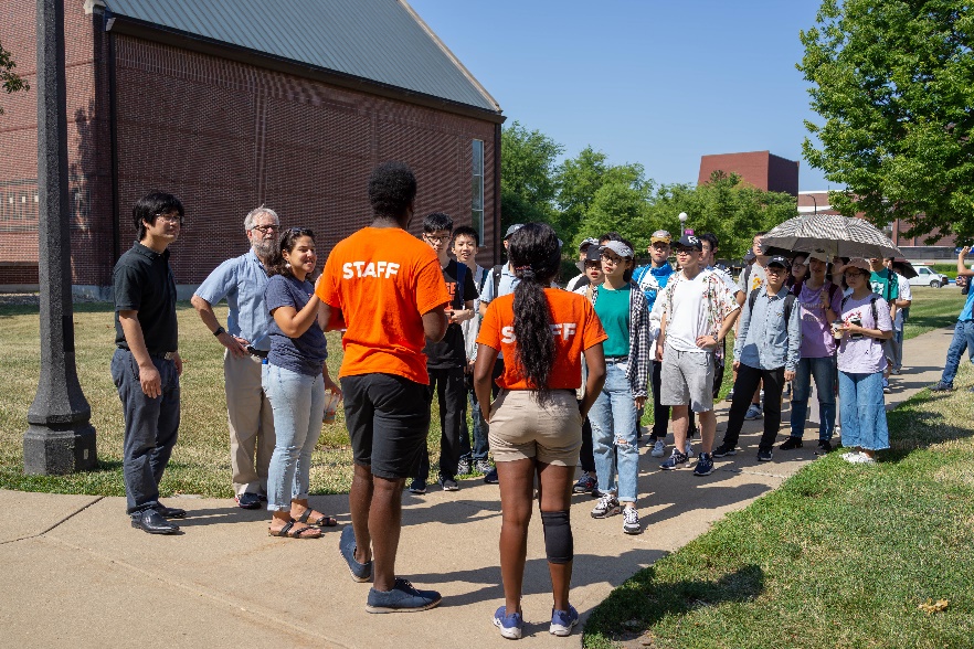
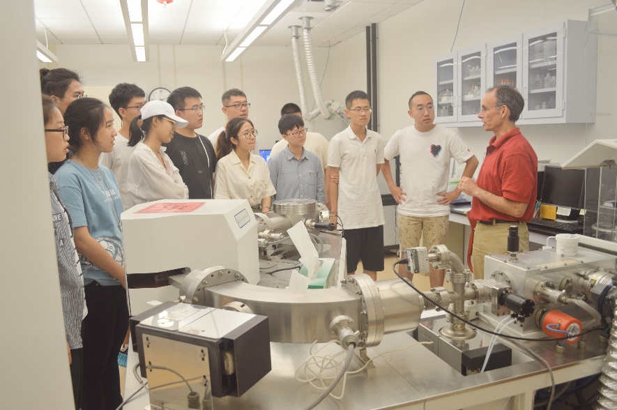
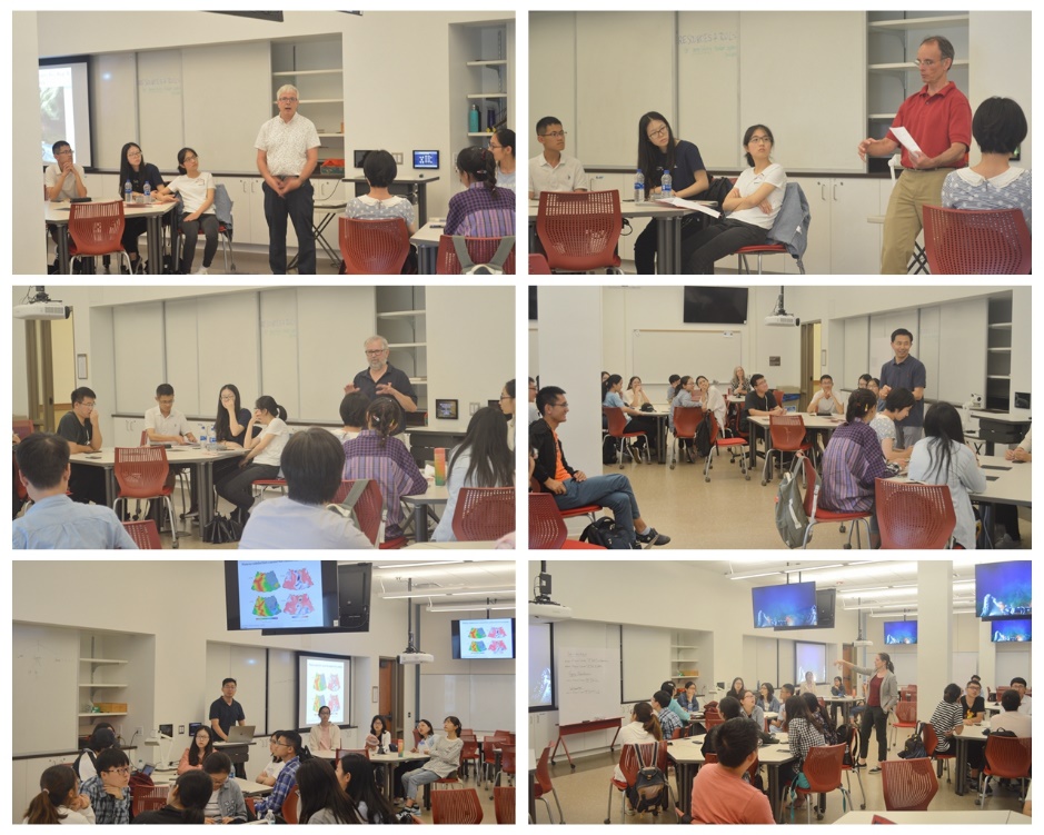
Professor Rob Rauber, Dean of SESE, extended warm welcome to the students and introduced UIUC and SESE. Du Zhenhong expressed his gratitude to the dean and introduced SES. He hopes that the two sides will further the cooperation to personnel training and scientific research. After the meeting, the students took a campus tour and visited the Virtual Reality Lab and CyberGIS Lab of SESE.
The students started the two-week course study from July 28th. The customized courses included Natural Hazards and Climate Risk, Geospatial Analysis on CyberGIS-Jupyter, geological field trip, and seven academic reports. It was rich in content and diverse in form.
The Natural Hazards and Climate Risk Course
The Natural Hazards and Climate Risk course were taught by Max Christie, from the Department of Geology and Brian Jewett, from the Department of Atmospheric Sciences. Dr. Christie introduced the geological hazard map and the related geography knowledge. Under his guidance, the students explored the geological internal factors of natural disasters such as volcanoes and earthquakes through independent analysis and rounds of group discussions, and carried out disaster evaluating such as disaster levels and impact areas. Dr. Christie encourages high level of participation in his classrooms, so that every student can experience the challenge of geological disaster research and enjoy the fun.

Researcher Jewett was responsible for the climate crisis course. He introduced the development and visualization of Python based on jupyter notebook, and the powerful visualization software VISIT. The 3D modeling of time series evolution left a deep impression on the students. At the end of the course, the students mastered the application methods of Python in climate statistics, visualization, etc., and learned how to use the software VISIT.
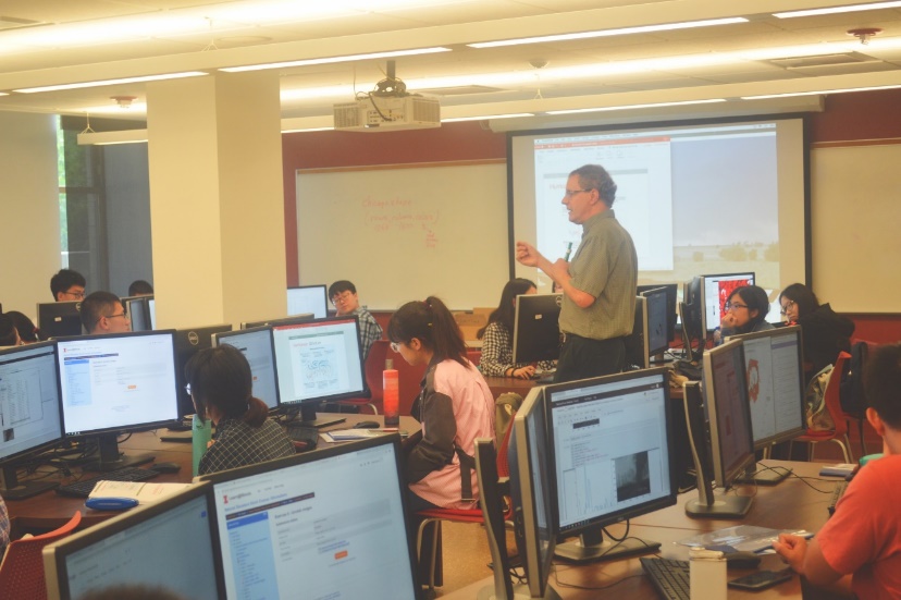
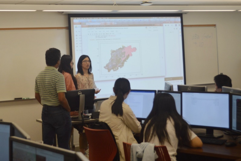
Geospatial Analysis on CyberGIS-Jupyter Course
The second week, Dr. Anand Padmanabhan, senior researcher from the Department of Geography and GIS, taught the theory, technology and application of CyberGIS. CyberGIS is a GIS concept that combines GIS with computer science and data science and it was introduced by Professor Shaowen Wang, the former deputy director of the National Center for Supercomputing Applications (NCSA) and the head of the Department of Geography and GIS at UIUC. The concept represents the future of the geographic information science. In the classroom, based on the CyberGIS-Jupyter platform, students learned how to use the functions provided by geopandas, fiona, rasterio and other packages to import, query, calculate, analyze and visualize data.

The students also carried out some experiments, included the query of attributes and the calculation of attribute values in various districts of New York, and the visualization of the population density around the world and the calculation of the flow direction and disaster analysis based on DEM data. The presentation session was the most popular sessions among the students. They used the knowledge they learned the previous day to practice CyberGIS in the field they study, such as geology, atmospheric science, human geography, etc. As a result, the CyberGIS applications done by the students were diverse and they enjoyed the collision of ideas and knowledge in the process. At the end of this course, the students mastered the basic operations based on the Python and CyberGIS platforms.
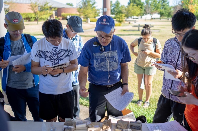
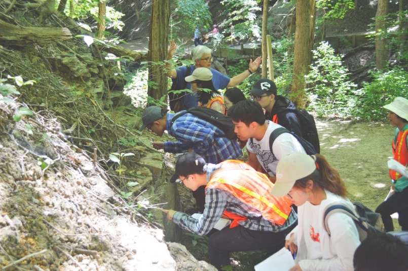
Geological Field Trip
August 9th, under the guidance of Associate Professor Stephen Altaner, Deputy Head of the Department of Geology, the students went to five sites (Farmland, White Oak Wind Energy Center, Messi National Park, Starved Rock National Park and Buffalo Rock National Park) in northeastern Illinois for geology field trip. Starved Rock National Park witnessed almost all geological and historical events that Illinois has experienced. Huge sandstone, the ultimate scorpion, the Illinois River from which it passes, and the preserved structure give it spectacular landscape and significant academic value. This field trip route is like a living textbook of geological history of Illinois. Stephen Altaner has guided different students walking through the route many times. His guidance and explanations were easy to understand, even for non-geological students. The trip cultivated the students’ ability to observe and understand geological phenomenon and the interest in observation.
Academic Report
SESE organized a series of academic reports for the students: Bob Rauber's report introduced radar research on extreme weather in cold conditions; Professor Robert Jeffrey Trapp, Head of the Department of Atmospheric Sciences, introduced the characteristics and causes of the tornado; Associate Professor Zhuo Wang introduced the formation mechanism of typhoon--the study of Dongfeng wave; Professor Patricia Gregg introduced the prediction model of volcano; Professor Tom Johnson shared his study of groundwater pollution by isotope analysis; Associate Professor Lijun Liu introduced the frontier of geology and geophysics; Professor Shaowen Wang, the head of the Department of Geography and GIS, shared the frontiers of CyberGIS. The reports covered both cutting-edge scientific theories and key technical methods, as well as the prospects from the macro vision, which greatly expanded the students' understanding of the frontier of earth sciences and inspired the students on their future learning and research.
Cultural Experience
During the summer school, GET arranged the students to visit Springfield and Chicago City during the weekend. The students visited the Lincoln Museum, the Lincoln Tomb, the Illinois State Government, the Lincoln Residence and the Chicago Art Museum to gain an in-depth understanding of the history and culture of the United States.
Closing Ceremony
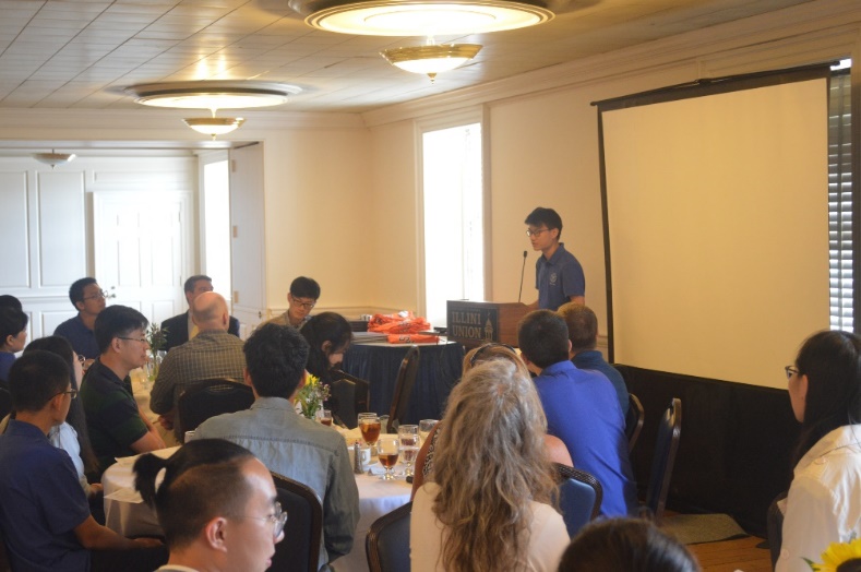
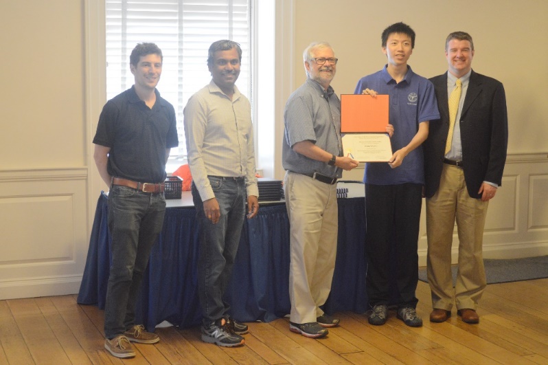
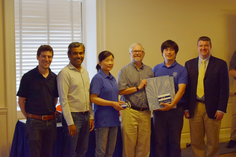
The closing ceremony was held at the Student Activity Center Illinis Union. First, Mr. Matthew Gadbury, deputy director of GET, fully affirmed the performance of the students in the two weeks, hoping to see the students again in UIUC next year. Then, Professor Rauber, congratulated on the success of the program. Student Chen Yizhuo spoke on behalf of the students to express the gratitude to the faculty members of SESE and the staff from GET. Subsequently, Rob Rauber, Max Christie, Anand Padmanabhan and Matt Rosenstein, the Director of GET, presented each student with a certificate of completion. Professor Rauber also presented gifts to Du Zhenhong, Zhu Jianli and SES.
The summer school was a success. The students experienced the university environment and campus culture in the United States. Also, the students participated in rich cultural exchange activities and improved intercultural communication skills. Most importantly, the courses greatly enriched the students' global vision in earth sciences.