

Editor: 谢佳 Author: Time: 2023-10-24 Number of visits :152
The northern margin of the Tibetan Plateau is defined by the left-lateral Altyn Tagh fault. It remains unclear whether the Cenozoic deformation related to the India-Asia collision has remained stationary along the Altyn Tagh fault or propagated northward into the southeastern Tarim Basin. The Cenozoic Cherchen fault is located in the southeastern Tarim Basin, ~90–120 km north of the Altyn Tagh fault, and thus, may play a critical role in addressing this issue (Fig.1). In this study, we used a densely-spaced two-dimensional seismic reflection survey to investigate the geometry and kinematics of the Cherchen fault and understand its role in the expansion of the northern margin of the Tibetan Plateau.
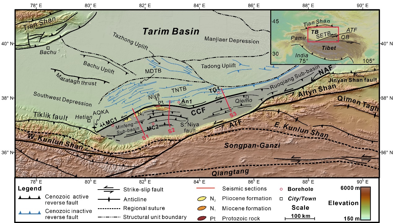
Fig.1 Simplified geologic map of the southeastern Tarim Basin and adjacent area. This map shows the locations of the major faults (black and blues lines represent Cenozoic active and inactive faults, respectively), boreholes (red circles), seismic sections (red line), and cities and towns.
Our seismic study shows that the Cenozoic Cherchen fault is a high-angle left-lateral transpressional fault. Kinematic analysis of the Cherchen fault suggests that a restraining bend structure has formed along its central segment. Stratigraphic records suggest that the Cherchen fault initiated in the Paleozoic and reactivated during the middle Miocene (ca. 17–15.7 Ma). We infer that the dip-slip and strike-slip rates of the Cherchen fault are ~0.09 mm/a and ~1.66 mm/a, respectively. A regional cross section reveals that the northward expansion of the plateau is ongoing, but the range is limited to ~90–120 km (Fig. 2). We interpret that middle Miocene tectonic activity throughout the region was also concentrated along the northern plateau margin, defined by both northeast-directed crustal shortening and northward expansion of the plateau.
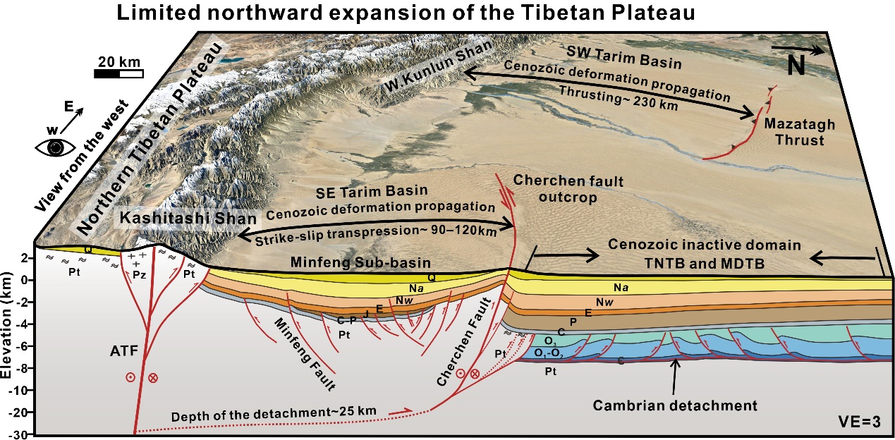
Fig.2 Regional satellite image and cross-sectional view of the Tarim Basin and northern Tibetan Plateau. The satellite image is from Google Earth imagery, and the regional geologic section is based on the composite seismic section. From the geologic section, Cenozoic deformation propagated from the northern Tibetan Plateau into the southern Tarim Basin. The Cherchen fault is the northernmost Cenozoic active tectonic boundary and the deformation front migrated ~90–120 km within the southeastern Tarim Basin by transpressional faulting.
Article information: Tian, H., Chen, H., Cheng, X., Wu, L., Lin, X., Gao, S., ... & Yin, Q. (2023). Limited Northward Expansion of the Tibetan Plateau in the Late Cenozoic: Insights From the Cherchen Fault in the Southeastern Tarim Basin. Tectonics, 42(7), e2022TC007694.